


Haddam 3 Voting District, Middlesex County, Connecticut
About
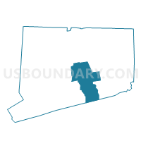
Outline

Summary
| Unique Area Identifier | 549879 |
| Name | Haddam 3 Voting District |
| County | Middlesex County |
| State | Connecticut |
| Area (square miles) | 6.83 |
| Land Area (square miles) | 5.78 |
| Water Area (square miles) | 1.06 |
| % of Land Area | 84.53 |
| % of Water Area | 15.47 |
| Latitude of the Internal Point | 41.49897600 |
| Longtitude of the Internal Point | -72.50660450 |
Maps


Graphs
Select a template below for downloading or customizing gragh for Haddam 3 Voting District, Middlesex County, Connecticut


Neighbors
Neighoring Voting District (by Name) Neighboring Voting District on the Map
- East Haddam 1 Voting District, Middlesex County, CT
- East Hampton 1 Voting District, Middlesex County, CT
- Haddam 1 Voting District, Middlesex County, CT
- Middletown 10 Voting District, Middlesex County, CT
Top 10 Neighboring County Subdivision (by Population) Neighboring County Subdivision on the Map
- Middletown town, Middlesex County, CT (47,648)
- East Hampton town, Middlesex County, CT (12,959)
- East Haddam town, Middlesex County, CT (9,126)
- Haddam town, Middlesex County, CT (8,346)
Top 10 Neighboring Place (by Population) Neighboring Place on the Map
Top 10 Neighboring Unified School District (by Population) Neighboring Unified School District on the Map
- Middletown School District, CT (47,648)
- Regional School District 17, CT (14,871)
- East Hampton School District, CT (12,959)
- East Haddam School District, CT (9,126)
Top 10 Neighboring State Legislative District Lower Chamber (by Population) Neighboring State Legislative District Lower Chamber on the Map
- State House District 48, CT (25,194)
- State House District 36, CT (23,652)
- State House District 34, CT (21,648)
Top 10 Neighboring State Legislative District Upper Chamber (by Population) Neighboring State Legislative District Upper Chamber on the Map
Top 10 Neighboring 111th Congressional District (by Population) Neighboring 111th Congressional District on the Map
Top 10 Neighboring Census Tract (by Population) Neighboring Census Tract on the Map
- Census Tract 5901, Middlesex County, CT (8,346)
- Census Tract 6802, Middlesex County, CT (6,726)
- Census Tract 5951.02, Middlesex County, CT (5,429)
- Census Tract 5502.01, Middlesex County, CT (3,954)
- Census Tract 5502.02, Middlesex County, CT (3,176)
Top 10 Neighboring 5-Digit ZIP Code Tabulation Area (by Population) Neighboring 5-Digit ZIP Code Tabulation Area on the Map
- 06457, CT (47,648)
- 06424, CT (12,808)
- 06441, CT (5,438)
- 06423, CT (5,097)
- 06469, CT (3,209)
- 06438, CT (2,550)
- 06456, CT (295)